Guatemala is the northernmost country in
Central America. It is bordered by the Pacific and the Caribbean,
Honduras, El Salvador, Mexico and Belize. The 11 million people
of Guatemala come from many diverse cultures, but the majority
are descendents of the ancient Maya Culture and defiantly
hold onto many of their traditions and native languages. The
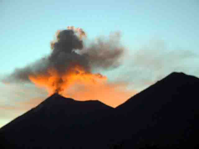
diverse landscape of towering mountains (over 33 volcanoes
rising as high as 14,400feet), dense cloud forests, lowland
jungles, expansive rainforests and crystal clear lakes and
rivers are home to a bountiful array of flora and fauna. All
of these factors make Guatemala a unique and interesting country
to visit.
Weather
Due to its geographical situation, between 14° and 18°
northern latitude, Guatemala is a country of tropical climate.
The average annual temperature is 20°C (68°F).
In the coast line area the temperature reaches
37°C (99°F), while low temperatures prevail in the
high mountains.
The climatic map of Guatemala contemplates;
The warm lands, located under 1000 meters
above sea level, where the seasonal temperature variation
ranges between 22°C and 26°C (72°-79°F) and
the seasonal difference is determined by the rainfall.
The tempurate lands, between 1000 and 2000
meters of elevation, with a temperature variation ranging
between 17°C and 22°C. (63° -72°F)
The cold lands that are located between 2000
and 3500 meters above sea level and where the annual average
temperature ranges between 10°C and 17°C. (50°-63°F)
And the higher lands situated over 3500 meters
above sea level, where temperature ranges from –10°C
to 5°C. (14°-41°F) The Tajumulco Volcano summit
(the highest in Central America) reaches an elevation of 4220
meters.
Guatemala has a dry season from October to
May and a wet season from November to April.
|